BATTLEFIELD ASSESSMENT

Overall’s Creek – Bell’s Mills

December 4, 1864

rutherford

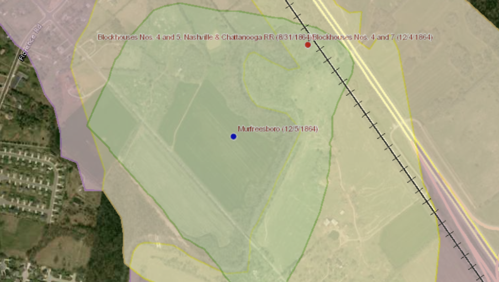
Confederate Gen. William Bate’s division engaged men of the 115th Ohio Infantry stationed in Blockhouse No. 7 protecting the Nashville and Chattanooga Railroad crossing at Overall Creek. The Confederates also engaged and drove the Fifth Tennessee (US) Cavalry across the creek. The retreating Tennesseans met the Thirteenth Indiana Cavalry and together those units pushed the Confederates back across the creek holding until Gen. Robert Milroy arrived with a makeshift brigade. The Union forces held the Confederates at bay and withdrew back to Fortress Rosecrans at 9 PM.

PRESERVATION OPPORTUNITY INDEX

MEDIUM

A rating assigned for each battlefield to indicate relative opportunity and potential for successful site preservation.

Help Preserve this Battlefield

Your support helps protect and share Tennessee’s historic battlefields for generations to come.

BATTLEFIELD IMAGE

Overall's Creek-Bells Mill's

SITE DETAILS

County

rutherford

Date

December 4, 1864

Preservation Opportunity

MEDIUM

Confederate Units

Brig. Gen. William Bate’s Division

Union Units

115th Ohio Infantry, 5th Tennessee Cavalry, 13th Indianan Brig. Gen. Robert Milroy’s Brigade

Overall’s Creek – Bell’s Mills

Account of Engagement

Report of Col. Gilbert M. L. Johnson, Thirteenth Indiana Cavalry, of operations December 4-9, 1864.

HDQRS. THIRTEENTH INDIANA CAVALRY, Murfreesborough, Tenn., December 10, 1864.

SIR: In compliance with orders received in communication dated headquarters, Murfreesborough, December 5, 1864, I have the honor to report that, in accordance with verbal orders received from Maj.-Gen. Rousseau on the evening of December 3, 1864, I took up the line of march with my command on the morning of December 4, 1864, toward La Verge, with the view of camping that night at that point.

Upon reaching a point some three miles distant from this place I met a detachment of the Fifth Tennessee Cavalry, which had been stationed at Overall’s Creek, retiring upon this point, being pursuer by the enemy. I ordered the captain in charge of the same to deploy his men as skirmishers on the left of the road, at the same time throwing a company of my command on the right, and proceeded in this manner one mile to the creek, the enemy’s skirmishers falling back to the opposite bank.

A brisk skirmish was kept up, the creek intervening, the enemy at the same time opening on us with three pieces of artillery. At this time I addressed a communication to the general commanding, of which the following is a copy:

HDQRS. THIRTEENTH INDIANA CAVALRY, Overall’s Creek, December 4, 1864.

Maj.-Gen. ROUSSEAU:

GEN.: I am holding the skirmish line at Overall’s Creek. The enemy exposed a line double to mine; reported moving column on my right flank; have used three pieces of artillery on me; also reported the same to by used on the blockhouse. Slight loss; skirmishing rapid; await orders; artillery moving toward their rear on the pike. Heavy artillery firing distinctly heard in the direction of Nashville. I shall endeavor to cross the creek.

I am, sir, your obedient servant,

G. M. L. JOHNSON, Col. Thirtieth Indiana Cavalry.

Help Preserve Tennessee's Civil War Heritage

Your support helps TCWPA preserve, interpret, and share the places where history happened for generations to come.

Other Ways to Support the mission

Terms Legend

Historical Themes:  Topics and subject matter that characterize the battlefield including Control of Tennessee’s Resources, Crucible for Leadership, Guerilla Warfare, Transformation in Warfare, Enslaved People, and Influence on Campaign.  Sites are identified that exhibit themes at moderate to high levels, and some sites may contain one or more Historical Themes.
 
Preservation Opportunity Index (POI):  A rating assigned for each battlefield to indicate relative opportunity and potential for successful site preservation.  The Index is generated by a model that evaluates ratings assigned for site significance, condition, risk of loss, protection potential, and opportunities for interpretation.  Based upon the POI values for each region in Tennessee (West, Middle, East), sites are indicated as having High, Medium, or Low opportunity.
 
Geo-coordinates: General/central location of the battlefield area per latitude and longitude coordinates utilized in Google Earth