November 11, 1864
Hamblen and Greene
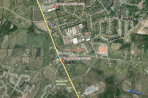
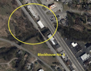
In November 1864, Confederate Maj. Gen. John C. Breckinridge mounted an expedition into East Tennessee from Virginia to secure food and forage and drive the Federals from the area. A Union force commanded by Brig. Gen. Alvan C. Gillem had advanced beyond Greeneville but retired in front of the larger Confederate army moving out of Jonesborough towards Greeneville. To protect the rail lines to Knoxville, the Gillem fell back to Bull’s Gap near Whitesburg on the East Tennessee & Virginia Railroad. On November 11, the Confederate forces attacked but were repulsed by 11:00 a.m. Both sides launched attacks the morning of November 12, but the Confederates gained little ground. Following skirmishing throughout the day on November 13, Gillem withdrew from Bull’s Gap toward Russellville late in the evening. After pursuing the retreating Federals as far as Strawberry Plain Breckinridge ultimately withdrew his army back into Virginia. The Confederate victory at the Battle of Bull’s Gap was a setback in the Federal plans to rid East Tennessee of Confederate military presence.
A rating assigned for each battlefield to indicate relative opportunity and potential for successful site preservation.
Your support helps protect and share Tennessee’s historic battlefields for generations to come.
County
Date
Preservation Opportunity
Confederate Units
Union Units
Your support helps TCWPA preserve, interpret, and share the places where history happened for generations to come.