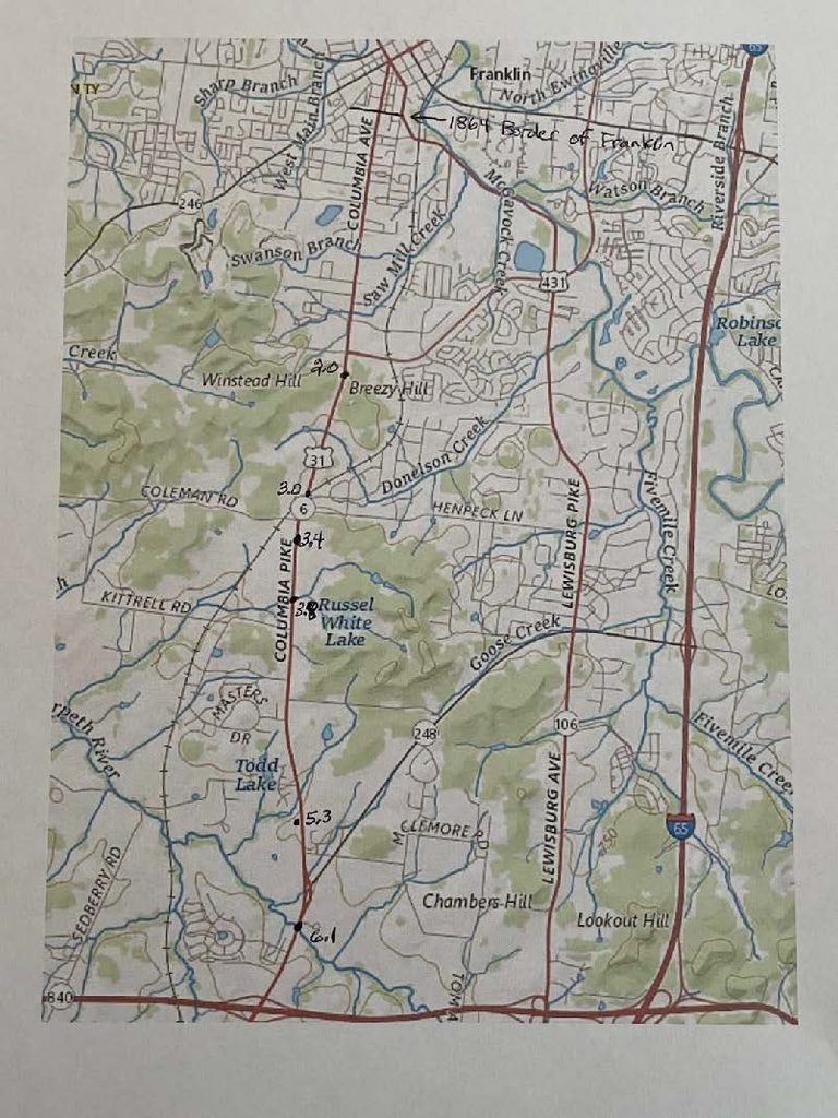
The Union pursuit took place over a distance of more than 4 miles along the Columbia Pike from Winstead Hill to south of the West Harpeth River.
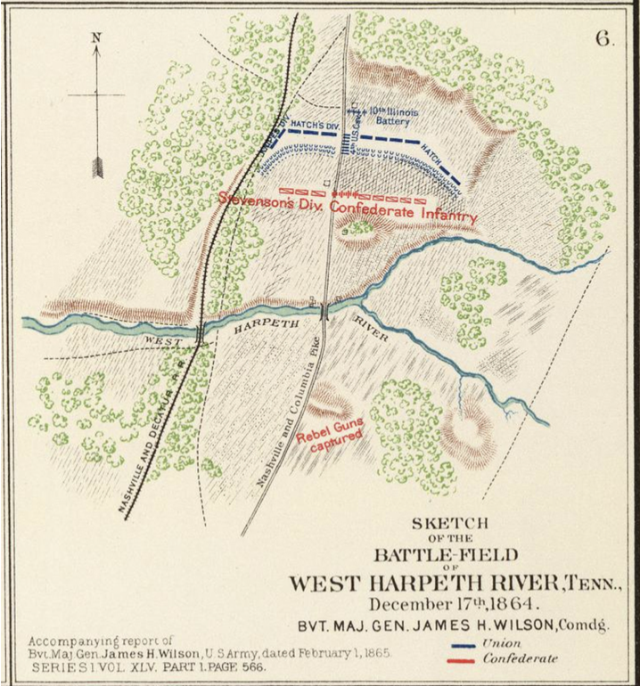
A major engagement occurred about 1-1/2 miles south of Winstead Hill between Coleman Road and a West Harpeth tributary which is depicted in the following map that accompanied General Wilson’s report (see Map 1).
A second major engagement started about 1 mile north of the West Harpeth near the James Johnson house (Laurel Hill) which still stands along the Columbia Pike.
A third engagement occurred south of the West Harpeth when troops from Clayton’s Division ambushed a Union column from Hammond’s brigade which had crossed the West Harpeth far to the left of Stevenson in an effort to get behind him.
Map 1: The map on the next page accompanied General Wilson’s report of February 1, 1865 which covered Hood’s Tennessee Campaign. The map was originally thought to depict the portion of the battle that occurred just north of the West Harpeth, but it was subsequently realized that the map matched the terrain near a tributary of the West Harpeth just south of Coleman Road.
The Union line as depicted is roughly 3.4 miles from Franklin. In his report, Col. Coon of the 2nd Iowa, who was commanding the Second Brigade of Hatch’s Division, describes an action that occurred 3 miles south of Franklin which must have been what is depicted in this map.
According to the Journal of the IV Army Corps, at 4pm Wilson was skirmishing 3 miles south of Franklin which provides the time frame for this engagement.
The map shows Confederate artillery being captured just south of the West Harpeth tributary. Two Medals of Honor were awarded for this capture, one to Lt. Joseph Hedges of the 4th US Cavalry and one to Major Eugene Beaumont who was on Wilson’s staff.
Interestingly, a close reading of the reports and accounts indicates that this capture may have actually occurred further south near the main West Harpeth River.